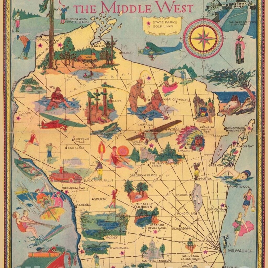

The map "Wisconsin - the playground of the middle west" by Elmer Krohn, published in 1929, presents an illustrated view of Wisconsin, highlighting its natural beauty and recreational opportunities. The map showcases the state's major attractions, including state parks, forests, lakes, and resorts, as well as its bustling cities, historic landmarks, and cultural events. The map's vivid colors, detailed illustrations, and catchy slogans aim to entice tourists to explore and enjoy Wisconsin's offerings. The map also includes information on transportation routes and distances, making it a practical tool for planning trips and exploring the state.
In addition to its practical and promotional value, the map reflects the cultural and economic context of the time. The 1920s were a period of rapid industrialization, urbanization, and social change in the United States, which created new opportunities for leisure and tourism. Wisconsin, with its abundant natural resources and scenic beauty, was a prime destination for those seeking recreational activities, relaxation, and escape from urban life. The map captures this spirit of optimism and excitement, reflecting the aspirations of the time and the growing importance of tourism in the American economy.