")
")
| Article number: | ART-WIHYMAPB |
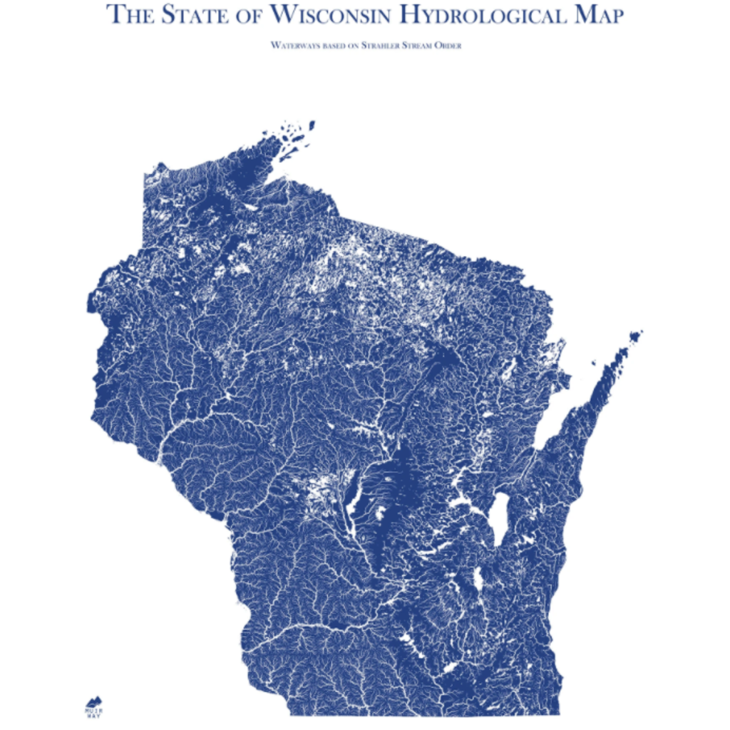
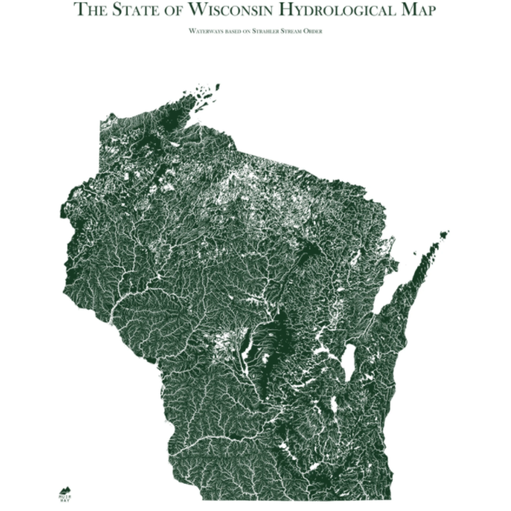
Water is literally the lifeblood of any state. If you’re drawn to water, you know that how and where it flows tells the story of a place. Our Wisconsin Hydrological Map shows in fascinating detail how the state’s rivers and streams flow and interconnect, merge and diverge, carrying life to the land. The flow of water also has an inherent aesthetic elegance that our map captures beautifully.
It’s all in the details. Our map depicts every river in the state—even intermittent streams—and every body of water with a diameter greater than .2 miles. For an extra aesthetic touch, we apply a method called the Strahler Stream Order to show the hierarchy of streams as they flow from their source—rivers are shown thicker as they acquire the flow of tributaries. We think it enhances a sense of the interconnectedness of our waterways.
Fine Art Paper- Museum-quality paper and inks assure sharp details, true colors, and exceptional durability.
- Archival Paper and Inks
- 100% cotton
- OBA-Free and Acid-Free
- Heavyweight 21.5 mil
- Certified to last 100 years